|
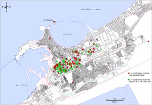
Locations of Alexandria's cisterns
as discovered from the Kamil files and the SRG map.
|
|
Archives
CEA - Map I. Hairy - © CEA
|
|
The study of Alexandria's water system 4th century BC to 19th century AD |
| The geography of the cisterns | Isabelle Hairy |
| The information presented below has been integrated into the Geographic Information System of the Centre d'Etudes Alexandrines and superimposed upon a map of Alexandria developed from the cadastral plans (1938 to 1950) on 1/500 and 1/1000 scale. Each location is marked by a code number to which are linked the data describing the cistern. |
| These have been superimposed onto the map of Alexandria. This type of information has been exploitable thanks to the "Goad Plans" of Alexandria, which were drawn up between 1898 and 1905 by a British insurance company. The memories of Alexandrians have also been a useful source of information. In general, we have cross-referenced different research criteria: toponymy, surrounding activities, names of Alexandrian notables and sometimes the persistence of characteristic forms in the urban fabric (particularly in the case of districts that have not changed since the end of the 19th century, such as Kom el Dikka). In the first instance, the positioning has been marked by simple points and we are now working to integrate the old plans into the actual urban parcels. |
|
|
 |
|
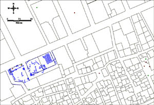
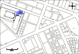
| This involves all the cisterns that have been seen and/or excavated. The database grows with each new discovery. |
 |
|