TOPOGRAPHY - Research
Geographic Information System (GIS)
Nelly Martin,
Latest up-date August 2002
The GIS is a complicated ensemble of information held within a database that can be represented graphically. It is conceived to respond to all questions with a geographical implication. It is, at the same time, a technical tool for use in cartography and the management of data whose purpose is to rationalise the management of space, natural resources, the environment and human activities in their globality and interaction.
In 1994, the director of the French Archaeological School of Rome launched an 18-month long project entitled "Mégapoles méditerranéennes". This was a study, from antiquity to till the present, concentrating on certain large Mediterranean towns, one of which being Alexandria. This project will be complemented by an atlas.
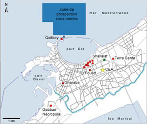
The start of this project was the occasion to take a close look at the cartographic documentation available in Alexandria. While a certain amount was available, it was apparent that no attempt had been made to map the ensemble of existing ruins. The ancient monuments have never been plotted on a base map of the modern city.
Faced with this fact, Jean-Yves Empereur decided to establish an urban archaeological GIS, which would be responsive to the needs of the CEA team. To approach such a task on the scale of an entire town was to be a first. He then contacted the ESGT and a student joined the CEA. From January to September 1995 this student took on the task within the framework of his final year diploma thesis. This beginning demonstrated the utility and feasibility of such a project.
The reference base map was to be the 1/500 cadastral plan of Alexandria drawn up in the 1930s and 1940s. Over more than three years, 832 cadastral sheets were digitised and stored on computer. The assembly of these sheets, now almost finished, provides us with a computerised map of 50000 urban parcels covering an area of more than 1100 hectares.
In 1996 and 1997, two other students from the ESGT continued with the construction of the GIS. Using two excavations in Alexandria (the site of the former Majestic Theatre excavated by the CEA in 1992-93, and the Finney land, adjacent to the former British Consulate, excavated by Achille Adriani in 1937-39), the students developed a process for integrating heterogeneous and complex data (site information, plans, drawings, photographs, etc.) They furthermore verified that the project fitted in with the working methods of the CEA archaeologists and could respond to their needs.
This research has continued throughout the years 1998, 1999 and 2001 thanks to the students of the ESGT and has now turned to setting up the GIS within the CEA's intranet. The data bases, maps, plans, etc. are now directly accessible on the computers of the CEA team.
The final aim of this project is to create a full archaeological GIS covering all the sites of Alexandria that will allow the consulting, questioning, comparing and juxtaposing of the graphic and descriptive data.
|
Photo legend:
|
|
|
Maps © CEA |